Showing posts with label aerial photos. Show all posts

Wednesday, September 11, 2024

Tornado v. Gas Station

Back when I posted about the Illiana Hotel sign in the bottom of a ravine, a reader suggested that it might have been blown there by a tornado that demolished a gas station at Route 30 and Randolph. The gas station, so I understand, had a number of signs like that on the walls.

I recently came across the Gazette story about the tornado and the gas station:

2024-09-11. 1976-03-17 Gazette, Tornado destroys south Hobart homes and businesses
(Click on image to enlarge)

Elsewhere the business was described as a "general store and gas station owned by Frank Horan,"[1] whom I can't identify with greater specificity.

On this 1958 aerial view, we find some kind of building already in existence on that corner (marked with a red arrow):

2024-09-11. 1958 aerial view - gas station marked
(Click on image to enlarge)
Image from the Indiana State Archives.


Here's an aerial view from 1978:

2024-09-11. 1978 images from lake co gis site
(Click on image to enlarge)
Image from the Lake County Surveyor GIS Website.


It doesn't look as if the gas station had been rebuilt, but the resolution of the image is not good. There is something about the size of a semi-trailer sitting on the lot. [9/17/2024 update: A long-time local resident tells me that Frank did not rebuild after the tornado. The land stood vacant until recently. The gas station/store had been very small, with one gas pump and, inside, a counter, some shelves with bread, candy, and cigarettes, along with a little cooler for such things as soda. Frank made much of his money repairing tires for semis traveling on Route 30. The family lived in the back of the building.]

The furthest I can go back in Google street view is 2009, at which time there was no sign that anything had ever been built on that corner.

(By the way, I have totally failed to identify the Hickory Grove Farm on the Old Lincoln Highway near County Line Road, also mentioned in the Gazette article above.)

♦    ♦    ♦

This is the first time in my 15 years of blogging that I'm indexing the surname Horan, and yet, looking at the census records, I find them in Union Township, Porter County, as early as 1930. And in the 1950 Census, there is a whole crowd of them there:

2024-09-11. Horan - 1950 census - Union Twp., Porter Co
(Click on image to enlarge)
Image from Ancestry.com.


In Center Township, the name goes back to the 19th century. However, as I said, I've not been able to determine whether Frank Horan, of the demolished gas station, was related to any Porter County Horans.


_______________
[1] "Tornado Kills DeMotte Resident," Vidette-Messenger (Valparaiso, Ind.), 13 Mar. 1976.

Thursday, January 4, 2024

The Glass-Coffin Madness

Eight or ten years ago, a long-time Hobartite told me a story about something that happened near Ainsworth, back (as she recalled) in the late fifties or early sixties: a rumor had started somehow that a man who lived down on County Road K (now known as South Hobart Road or Randolph Street) was keeping a woman's dead body in a glass coffin in his house, so people started driving by the house trying to catch a glimpse of the glass coffin.

When I mentioned the story to Eldon Harms, he recalled the incident, and even showed me where the house in question had been. I took away the impression that it was just a matter of some bored teenagers acting silly, so I was surprised to find not only that the glass-coffin madness had earned a mention in the Gazette, but that I had underestimated its magnitude …

2024-01-04. 1961-10-05 Where Is The Casket, Gazette
(Click on image to enlarge)
Hobart Gazette, 5 Oct. 1961.


… and I was shocked by the tragic way it all ended.

2024-01-04. 1961-10-12 Area Man Takes His Own Life, Gazette
(Click on image to enlarge)
Hobart Gazette, 12 Oct. 1961.


Stories about Stanley Wiernasiewicz's suicide and the bizarre events that led up to it appeared in newspapers as far away as Texas and California.

♦    ♦    ♦

These articles have prompted me to take a closer look at the area where all this happened.

On this screenshot from the Google satellite view on the area, the arrow marks approximately where Eldon said, "Here!" as we were driving down the road:

2024-01-04. screenshot aerial view marked
(Click on image to enlarge)
Image from Google.com/maps.


The 1939 Plat Map shows the original Wiernasiewicz farm of 34 acres, purchased in April 1930 from John Bodamer.[1] Later, the family would also buy the 40 acres across the street.[2]

2024-01-04. 1939 plat map Wiernasiewicz farm
(Click on image to enlarge)

The 1930 purchaser, technically, was Mary Wiernasiewicz. The plat map shows the owner's first name as Chester. I have tried and failed to identify a Chester among the Wiernasiewiczes. I suspect that might be an error on the part of the plat-map maker.

Here is the farm in a 1939 aerial photo (I hope I got the boundaries right):

2024-01-04. 1939 aerial Wiernasiewicz farm marked
(Click on image to enlarge)

♦    ♦    ♦

For the first time since I started researching Ainsworth history, I have looked into the Wiernasiewicz family. The research wasn't easy: in dealing with a last name like Wiernasiewicz, you naturally get alternate spellings and mistranscriptions. (In fact, one member of the family ended up amputating all but the first syllable of his surname, to make his own life easier, I suppose.)

It appears this family included some interesting people — interesting and enterprising; perhaps a bit too enterprising.

The story begins with Andrew Wiernasiewicz and Mary Fusko, who both came from Poland, but separately: she in 1900 at about 6 years of age, he in 1902[3] when he was about 13, according to the 1930 Census. They were married circa 1910 (I can't find the record), possibly in Pennsylvania, where their first son, Stanley, was born. By 1913 they had come to Indiana. The 1920 Census shows them living at 1949 Virginia Street in Gary, now with another son, Michael, born in 1913.[4] (In 1916, they had had a little girl, Aniela, who lived only a few months.) Also in their household in 1920 was a roomer, another Polish immigrant who, at the age of 86, was still working in a steel mill. Andrew worked in a steel mill too. Mary's occupation is given as "none"; however, three years later we find her operating a "soft drink parlor":

2024-01-04. Close Up Soft Drink Parlor -- The_Times_Sat__Apr_14__1923_
(Click on image to enlarge)
The Lake County Times (Hammond, Ind.), 14 Apr. 1923.


The 1930 census shows the Wiernasiewicz family living at 1837 Virginia, with yet another son, nine-year-old Walter, as well as two roomers. Andrew worked as a machinist in a bolt factory. Mary managed a grocery store.

Andrew may have had a side job, if this is our guy (and I can't find anyone else by that name in Gary):

2024-01-04. Gary, The_Times_1933_06_23_page_13 (Andrew Wiernasiewicz)
(Click on image to enlarge)
"Gary," The Lake County Times (Hammond, Ind.), 14 Apr. 1923.


In April 1930, as we know, the farm on County Road K had been purchased. But it doesn't look as if the Wiernasiewiczes became full-time farmers. A 1935 Gary directory shows the family both living and operating a grocery store at 1839 Virginia Street. They may have rented their farm out, or hired someone to run it for them.

In spite of the repeal of Prohibition, Mary still found ways to violate liquor laws.

2024-01-04. Wiernasiewicz, Mary -- The_Times_Mon__Dec_23__1935_
(Click on image to enlarge)
The Lake County Times (Hammond, Ind.), 23 Dec. 1935.


The 1940 Census records the family still in Gary. It doesn't say anything about Andrew's or Mary's occupation, but I find it difficult to believe that they were idle. Stanley was working in a steel mill, Mike bartending in a tavern, and 18-year-old Walter was described as a "New Worker" (meaning, I believe, that he was an inexperienced person in search of a job).

In 1946 we come across a previously unheard-of Wiernasiewicz who followed the family tradition of running afoul of liquor laws:

2024-01-04. Lily Ann Wiernasiewicz, The_Star_Press_1946_10_15_Page_5
(Click on image to enlarge)
The Star Press (Muncie, Ind.), 15 Oct. 1946.


Lily Ann turned out to be Walter's wife, or possibly at this point his live-in girlfriend using his last name — the only record of I can find of Walter Wiernasiewicz marrying a Lily Ann (maiden name Brewer) comes in 1953.[5]

When Mary Wiernasiewicz died in 1948, her address, and Andrew's, were given as Rural Route #2, Hobart (Indiana Death Certificates), which sounds like the farm on "County K." And that is where Andrew and two of his sons, Stanley and Michael, were living when the 1950 census came around.

The census records Walter and Lily, along with a 70-year-old lodger but no children, living in a separate household on what sounds (per the enumerator's notes) like the same road as the Wiernasiewicz farm. Walter described himself as a farmer. By 1950 the family had bought the 40 acres across the road from their original 34 acres, which may account for the separate households.

In 1951, Michael died at the age of 37, unmarried and with no children I know of. Andrew's being named as the informant on Michael's death certificate is his last appearance in any record I can find. I suspect that Andrew died sometime between 1951 and 1961. When Stanley died in 1961, it was not his father who reported his death and applied for a veteran's grave marker, but his brother (going by the name Walter Weir). No news story mentions Andrew. I cannot find Andrew's death certificate; it may be among the illegible ones listed on Ancestry.com, or the name may have been hopelessly mistranscribed.

Andrew probably lies in Calvary Cemetery with the rest of his family, though perhaps in an unmarked grave. If Stanley ever got his veteran's marker, it hasn't been photographed for findagrave.com.


_______________
[1] "Real Estate Transfers," Lake County Times (Hammond, Ind.), 14 Apr. 1930.
[2] I believe the "L.E. Nelson" who owned that 40-acre parcel in 1939 was someone we've met before: Lovisa Elizabeth (Chester) Nelson.
[3] Sources vary on this.
[4] I got his birth year from his death certificate; the 1920 enumerator appears to have been confused. It is possible that Michael sometimes went by another name. I have found a 1913 birth certificate for a Jan Wiernasiewicz, born to Andrew and Mary the same day as Michael — but no birth certificate for Michael. I have also found a 1937 Gary directory listing showing an occupant of the Wiernasiewicz household named Joseph, which was Michael's middle name (per the death certificate). But no census calls him anything except Michael.
[5] Maybe they were divorced earlier and remarried in 1953. Unfortunately, I don't think the 1953 marriage lasted long, as Lily Ann Brewer shows up in 1954 marrying somebody else. But there is also a record of Walter Weir getting a license to marry Lily Brewer (both described as Hobart residents) in Berrien County, Michigan, in 1955 ("Marriage Licenses," The Herald-Palladium (Benton Harbor, Mich.), 28 Sept. 1955). Walter's 1980 death certificate describes him as divorced.

Thursday, May 28, 2020

Ready to Cut the Wheat

2020-05-28. EvaT027
(Click on image to enlarge)
Image courtesy of Eldon Harms.


The photographer is standing on Ainsworth Road just west of County Line road and pointing the camera south(west), toward the big barn on the farm the Thompson family rented.

There are four horses, two men, a woman, and two dogs. The photo isn't clear enough to identify anyone, although, to me, the woman looks vaguely like Nancy Thompson.

There is no date. I'm guessing, very roughly, at the early to mid-1920s.

As for the machine, here are the notes I took as Eldon Harms told me about it:
The machine is a binder. The rotating arms with horizontal planks knock the grain against the sickle bar at the bottom to cut it. It cuts wheat/oats and binds bundles of grain (ties it up themselves), continues filling up with bundles to a set number, at which point it drops them all at once so you can shock them. Grain is left to dry and cure (maybe days or weeks); then you gather all your bundles and haul them to one place to be threshed. How to tell if grain ready for threshing? You can rub it on your hand to see how dry it is. Some guys chewed on a grain to judge.


If the big barn was still standing in 1939 (at which time the land was owned by Michael and Julie Carrozzo), we can tell where it stood from the aerial photo of that time.

2020-05-28. Large outbuilding 1939
(Click on image to enlarge)
Photo from https://igws.indiana.edu/IHAPI/.


Monday, October 6, 2014

Hobart from the Other Water Tower, 1931

Not the one the librarian climbed, but the new water tower at the east end of what would someday be Jerry Pavese Park. (To see the water tower, look straight up from the first "i" in "Historical" in this circa 1959 photo.) This time, the tower-climber was probably a high-school student, who took these photos printed in the 1931 Aurora yearbook.

2014-10-6. 1931001
(Click on images to enlarge)


The first photo looks eastward along the Nickel Plate tracks. You can see the white steeple of the Unitarian church south of the tracks. I am not sure what that tower is, north of the tracks near the lake — perhaps it's for the police/fire radio, if such a thing existed in 1931?

2014-10-6. 1931002


In the second photo, we see the streetcar barns in the foreground, and then Third Street crossing the lake into the heart of downtown.

2014-10-6. 1931004


The photographer turned more westerly for the third photo. We see Third Street across the foreground, dotted with houses, and beyond it, I believe you can see streets all set out and ready to be built up — Burling Place, Court Street, West 2nd Street …

2014-10-6. 1931005


The fourth photo looks across the lake toward Wisconsin Street. Not much to see!

2014-10-6. 1931006


The last photo takes in the residential area south of downtown Hobart, on the banks of the lake — that is, the area of Water, Lake, 5th, 6th, 7th Streets.

2014-10-6. 1931007

Sunday, August 17, 2014

The Shadow of the Speedway

The Hobart Historical Society museum has on display a gigantic aerial photo of Hobart dated 1967. Seriously, this thing is about seven feet high and wide.

Although by 1967 the Hobart Speedway was long out of use, on that photo you can still see its shadow in the fields south of Cleveland Avenue. This is probably the sort of thing that could not be seen from ground level, only from the air.

Here is a photo I took yesterday of that part of the gigantic aerial view.

IMG_6793 copy

Here it is with labels:

IMG_6793 labeled

You can see the whole set of images I took, trying to get a good shot, here.

Tuesday, August 12, 2014

Harms Road

From the Lester Harms collection.

Harms Road is an odd little stretch of two-lane blacktop just south of Route 30. It cuts diagonally across the countryside to connect two regular east-west section roads, E. 83rd and E. 89th. Back in the old days (circa 1930s, perhaps later) it was known as the Sitzenstock Road in honor, I believe, of the family of Ernest and Emma Sitzenstock, whom we find on the 1908 Plat Map owning a farm that straddled the road just as it dove southwest from present-day E. 83rd Ave. Its name was changed in honor of Lester and Mathilda "Sue" Harms, who owned 80 acres at the junction of Colorado St. and the Sitzenstock road at the time the road names were being formalized and set — well, not in stone, but on street signs and maps, I suppose. Why them, instead of any of the other landowners along that road? Perhaps they had been there longer than anyone else, but if that's the case then the street name must have been assigned sometime after 1950, when the Sitzenstocks still owned their old farm.

1950 Harms Sitzenstock
(Click on image to enlarge)
From the 1950 Plat Book.


Or maybe "Sitzenstock" wouldn't fit onto a street sign.

Anyway, today our selection from the Lester Harms collection is an undated aerial view of the farm that gave Harms Road its name.

2014-8-12. lh091
(Click on image to enlarge)
Image courtesy of E.H.


We are looking northwest. Lester's farm is in the foreground, with Harms Road running in front of it, horizontally across the picture. Beyond it you can see Colorado Street. The little collection of buildings and trees on the west side of Colorado is the farm of William and Louise Prochno. Their daughter, Mathilda, after losing her first husband (Noland White), would become Lester's second or third wife — I am really confused at this point over how many times Lester was married and to whom.

Today, Lester's former house and the big barn are still standing. Maybe some of the other outbuildings are, too, but I'm not sure. Nothing is left of the Prochno buildings.

Saturday, May 31, 2014

Merrillville From the Air, 1939

Here we have two aerial photos of Merrillville from 1939.

2014-5-31 BFJ-03-086
(Click on images to enlarge)
Images courtesy of the Indiana Geological Survey, I.U. Bloomington.


2014-5-31 BFJ-03-087

I got these thinking they would clarify the location of the railroad depot, but I was wrong. There are two rectangles in that vicinity and we're not sure which is the depot.

Friday, May 17, 2013

Motorcycle Racetrack?

Someone had told me that you can still see traces of Hobart's motorcycle racetrack in the landscape, so I was looking on the Google Maps satellite view for it. I didn't see any such thing, but I saw something cute in roughly the same location. I think it's a corn maze. Go and look if you don't believe me. (This is Google Maps, now, not Google Earth, and you really have to zoom in.)

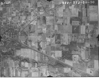
However, to return to history, here's a 1938 aerial view of that general area. It includes an oval line in the fields that could be a racetrack, in what seems to me about right for the location of the McAuliffe land.

BFJ-01-090 Hobart motorcycle racetrack
(Click on image to enlarge)
Image courtesy of the Indiana Geological Survey.


Here, I'll do my label thing.

Hobart motorcycle racetrack detail
(Click on image to enlarge)

So? Whaddaya think?

Saturday, February 18, 2012

1939 Aerial Photos of Hobart: South of Hobart

These last three aerial photos start with Hobart, then move south to Ainsworth. This is territory we've covered before.

BFJ-04-067
(Click on images to enlarge)

BFJ-04-068

BFJ-04-069

Thursday, February 16, 2012

1939 Aerial Photos of Hobart: Southwest of Hobart

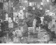
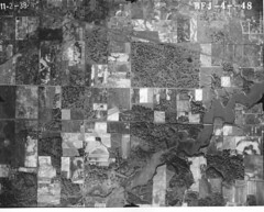
The next three photos move north from the one we've just seen to show us the farmland and woods southwest and west of Hobart. These photos overlap each other somewhat.

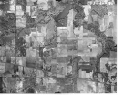
In this first one, the Grand Trunk Railroad runs diagonally across the lower third of the photo, while at the top you can see the Deep River beginning to widen into Lake George.

BFJ-04-046
(Click on images to enlarge)

The next two just continue moving north.

BFJ-04-047

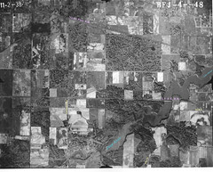
BFJ-04-048


Here's that last one again with some of the features labeled.
BFJ-04-048 marked

Tuesday, February 14, 2012

1939 Aerial Photos of Hobart: West of Ainsworth

OK, finally getting back to these few aerial photos of Hobart in 1939, only one of which I already posted.

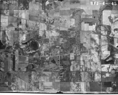
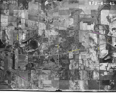
Here we have the area west of Ainsworth, surrounding the old Lincoln Highway. The far left of this photo shows the area where I-65 now runs north-south. The new Route 30 runs east-west across the bottom of the photo. Other than that, mostly just farmland.

BFJ-04-045
(Click on images to enlarge)

Here it is again with some of the features labeled.

BFJ-04-045 marked

Wednesday, July 27, 2011

Bird's-Eye View of Hobart, 1901

Birdseyeview1901
(Click on image to enlarge)
Image courtesy of the Hobart Historical Society.


This bird's-eye view, probably taken from the top of the water tower, is dated 1901 so it's probably about 16 years older than the similar one I posted earlier. This is a large file, but it's worth it. The laundry hanging on the lines! The backyard privies! The scrap piles! The windmill behind that building on Main Street! The white horse in motion in the foreground! Not to mention the acres and acres of open fields on the west side of Lake George.

Notice the bell between the white frame building and the white frame house just below the center of the scene — that was the fire alarm bell. (And doesn't that white frame building resemble the Red Front building I was wondering about … just with some 13 years' worth of remodeling? On the other hand, it's not very distinctive — anyone, anytime could throw up a building like that.)

Where Main Street runs off the right edge of the photo, I think that's the original St. Bridget's Church, the original frame church that was eventually replaced by the second one (seen in this post), which was then replaced by the present one. Am I right?

Saturday, June 4, 2011

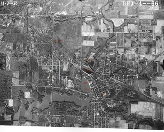
1939 Aerial Photos of Hobart: Streetcar Line

BFJ-04-066
(Click on image to enlarge)
Image courtesy of the Indiana Geological Survey, I.U. Bloomington.


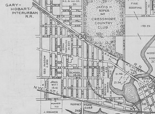
Well, this is embarrassing. I just realized that if I'd been paying attention when I looked at the 1939 Plat Book, and if it had registered in my brain that "Gary-Hobart Interurban R.R." refers to the streetcar line, I wouldn't have had to schlep my aerial prints over to an old-timer's house to ask if this photo really does show the streetcar line, because according to the plat book, it does. (However, it was a pleasant visit, as always, so I'm not complaining … just embarrassed.)

1939HobTwpEaststreetcarline
(Click on image to enlarge)

This image from the 1939 Plat Book shows the streetcar line, aka the Gary-Hobart Interurban R.R., running through Hobart. By this time its Hobart terminus was at the northwest corner of Third and Main. From there it ran along the north side of Third Street until it crossed the bridge; then it ran down the center of Third Street. Around Ash Street it moved away from Third Street to cross Connecticut and Pennsylvania diagonally. At First Street (now West Cleveland Ave.) it joined up with Washington and ran down the center of that street up to the Pennsy R.R. There it made a turn and ran along the south side of the railroad tracks until they crossed 37th Avenue, at which point the streetcar line turned west to run along the north side of 37th Avenue straight to Broadway in Gary, where it probably met up with the Gary streetcars, which (I am told) ran up and down Broadway.

If you go to Google maps or Mapquest for a present-day satellite image, it looks to me as if that paved alley moving diagonally northwest from Ash Street is a vestige of the streetcar line, as far as it's diagonal — it soon turns straight north and leaves the path of the streetcar. And maybe I'm seeing things, but there seems to be a slight imprint of the streetcar line left in people's yards on either side of Connecticut, mid-way between Second and Third Streets.


Here's that aerial photo decorated with colored labels. You know how I love doing that. Also a few guesses at what's what.

BFJ-04-066decorated
(Click on image to enlarge)

I've got 6 or 7 more aerial photos that I'll get up here eventually, but this is the most interesting one.

Monday, December 6, 2010

Aerial View of Hobart Circa 1917 (From the West)

Birdseye1919
(Click on image to enlarge)
Image courtesy of the Hobart Historical Society.


Back in September when I posted a circa-1917 view of Hobart taken from the water tower, I said we'd be hearing more of the icehouse visible in the background of that photo.

I said that because I have this image which looks as if it had been taken from the roof of the icehouse. Here we're on the west bank of the Deep River and Lake George, with Third Street crossing the river at right (and you can see the streetcar tracks running alongside the road).

I have "1919" in my notes for this, but I have to question whether that's correct because the Strattan building still seems to have its curtain loft, which was dismantled in (I believe) the summer of 1917.

Some distance to the right of the Strattan building and just before the trees completely take over, you can see a steeple which I think belongs to the M.E. Church. It looks more like the modern structure than the original one. If I'm right about that, this photo must have been taken after the autumn of 1916, when the modern church was built.

On the left of the photo you can see the white corner bay window of the building that I couldn't believe existed on the corner of Main and Second. Now I believe.

The biggest building to the left of Third Street is, of course, the Hobart House.


Sources:
♦ "Curtain Loft of Strattan Building Being Torn Down." Hobart News 28 June 1917.
♦ "M.E. Church Will Lay Cornerstone Saturday." Hobart News 17 Aug. 1916.

Thursday, September 23, 2010

Aerial View of Hobart Circa 1917

Birdseye1917
(Click on image to enlarge)
Image courtesy of the Hobart Historical Society.


Thank goodness for the Hobart Historical Society and all those interesting historical pictures they have. Anytime I want to slack off, all I have to do is put up one of those nice old pictures I scanned at the museum and voilà — my post for the day. (Assuming I don't do a then-and-now. Which I'm definitely not going to do in this case!)

I'm guessing that some brave photographer climbed to the top of the tower of the Hobart water and light plant, or whatever it was called, to take this photo of downtown Hobart, looking toward the west over Lake George. That's Third Street running from the foreground up to the lake.

That large blocky structure just off Third Street on the other side of Lake George (slightly left of center in the background) is an icehouse. We will be hearing more of that the next time I want to slack off.

The other large structure further left in the background is the roller coaster in the former amusement park. I say former because I think it was abandoned by then.

Someone who seems confident of their knowledge has written "1917" on the picture; otherwise I might think it had been taken by Hobart's librarian in 1915:

9-23-2010 Dorothy Thomas
(Click on image to enlarge)
From the Hobart News of August 19, 1915.


I suppose this is the tower she climbed:

WaterTower
(Click on image to enlarge)
Image courtesy of the Hobart Historical Society.


This image is from a postcard postmarked December 20, 1910. Howard Shearer sent it to Elsie Wojahn, and so I have another entry for my collection of their correspondence.

[update] And here's the "brave girl" herself:

DorothyThomas

Wednesday, March 10, 2010

1973 Aerial Photos

Click on images to enlarge if you dare. These are big files.

These photos were taken from such a high altitude that it's difficult to see any ground-level detail. This first one is eastern Lake and western Porter Counties. The intersection of Ainsworth Road and Grand Trunk Railroad is at the left edge of the photo, a little more than one-third of the way from the top. You can clearly see the race track where Deep River County Park remote-controlled airplane field is now. They've made its shape more regular and symmetrical since 1965.

1973ELakeWPorter
All three photos in this post are courtesy of the Indiana State Archives, Indiana Commission on Public Records.

In this image, the Deep River race track/airplane field is toward the right border. At left is the intersection of I-65 and U.S. 30, and we can see what looks to be Southlake Mall in its early stages, perhaps under construction.

1973ELakeJctI-6530North

Here's another shot that includes Southlake Mall. Ainsworth is under the "18089" at top right.

1973ELakeJctI-6530

In these two last images, there is what appears to be a railroad, or the remains of a railroad, running diagonally across the landscape, crossing Route 30 just east of Southlake Mall, then continuing northwest under I-65. I was glad to see this because it might be the railroad that's had me mystified as I've been reading the early-1900s Hobart Gazette. A new railroad was just being proposed in 1901; construction began in 1902, with the railroad entering Lake County from the east where Ross Township and Winfield Township meet, then continuing northwest to a depot in Merrillville, and by 1904 it had reached Griffith. I didn't remember ever seeing such a railroad. The Gazette called it the Cincinnati, Richmond & Muncie Railroad, but also once referred to it as the Chicago, Cincinnati & Louisville Railroad. At last reading, in 1904, the railroad was still seeking terminal facilities in Chicago, and had already killed one person in Merrillville.


Sources:
♦ "General News Items." Hobart Gazette 18 April 1902, 23 May 1902, 27 June 1902, 18 July 1902, 5 Sept. 1902, 21 Nov. 1902, 29 May 1903, 4 Dec. 1903, 18 Dec. 1903, 13 May 1904, 24 June 1904.
♦ "Railroad Elections." Hobart Gazette 11 Oct. 1901.