Monday, November 30, 2009

The Klan at Work in Ainsworth

Henry J. Paulus ran a general store in Ainsworth for a brief time — so brief that I can find no trace of him in the census reports.

One evening in 1924, he attended a political party in Ainsworth. He returned from it to find "a group of hooded men burning a cross in front of his store … who he believed were KKK members." Mr. Paulus was Catholic, which was probably what angered the Klan. An investigation by federal agents failed to catch any of the culprits.

The incident did not make the papers at the time. We know about it only from a newspaper article 22 years later. In July 1946, somehow the Vidette-Messenger found out that the Klan had paid a second visit to Mr. Paulus, who now owned a hardware store in Los Angeles. This time, the paper reported, a cross had been planted in front of Mr. Paulus' home, but he took it less seriously than the earlier incident.

In June of 1926, we find Mr. Paulus advertising his Ainsworth general store for sale. By March 1927 he had sold out to "Mr. H. and George Argus." I don't know whether his decision to leave Ainsworth was a result of Klan intimidation.

Sources:
♦ "Former Ainsworth Resident Gets 2nd Klan 'Visitation.'" Vidette-Messenger (Valparaiso, Ind.) 15 Jul. 1946. Access Newspaper Archive. Lake County (IN) Public Library 29 Nov. 2009 .
♦ "Hobart." The Times (Hammond, Ind.) 15 Mar. 1927. Access Newspaper Archive. Lake County (IN) Public Library 29 Nov. 2009 .
♦ "Real Estate for Sale." The Times (Hammond, Ind.) 1 Jun. 1926. Access Newspaper Archive. Lake County (IN) Public Library 29 Nov. 2009 .

Sunday, November 29, 2009

Commerce: Popp

AndreasPoppandchildrenincludingChar
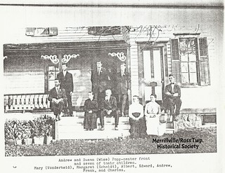
The Popp Family (click on image to enlarge)

When I wasn't looking, Charles (pictured above) and Lucy Popp swept into Ainsworth and opened a grocery store. The first I ever heard of these two was when Lucy made it into Along the Route for getting herself appointed postmistress.

I know very little about Lucy because I can't find her maiden name. In 1933, after the birth of one of her children, her mother came down from Chicago to help out, but the newspaper reporting that visit fails to give the mother's name. And so, apart from Lucy's birth (March 23, 1901) and her not-quite-four years as postmistress, all I can say is that she married Charles Popp and bore his children. Indeed, that seems to be all I can say about most of the women of whom I speak in here, except Carrie Chester Raschka. My research is fairly superficial, dealing only with public records and newspapers, and those sources show women as someone's daughter, then someone's wife, then someone's mother, then someone's widow, and then they die. Newspapers speak of women as "Mrs. John Smith" or even just "Mrs. Smith." Women pay social visits, which are sometimes recorded, and they hold meetings of ladies' clubs; they occasionally perform in public musical recitals. A better writer and a deeper researcher might make a story from those activities.

The newspapers so far haven't given any hint of the less respectable things a woman might possibly get up to — not regarding these Ainsworth women, I mean. Other women in other places were involved in all sorts of scandalous things, and here I can't even get a woman arrested. Although — who knows? — maybe John Chester was taking the fall for Emma in that bootlegging business.

Anyway, now that I've explained the androcentrism of this blog, let's get more androcentric and move on to Charles Popp.

He came from a relatively old local family. Both his father, Andreas, and his mother, Susannah (née Weis), were born in Lake County. Charles was born April 18, 1895, in Merrillville. (Take a look at Susannah Popp in the photograph above. She looks very good for having borne eight children, doesn't she? — and that's eight children who show up on the census. There may have been more.)

It was a farming family. The 1910 census finds Charles still at home on the farm, but within a few years, it seems, he'd had enough of farming. He went to work for the Grand Trunk Railroad as a pump man at the Lottaville station.

I had to go look up what a "pump man" does. Here's a job description circa 1918:
Description: The pump man must operate pumps and keep a constant water supply in tanks or troughs. He must be able to run any sort of small gasoline, electric, or steam pump. He should understand the firing and care of a small steam boiler.

Qualifications: The pump man should know enough about the machinery to keep it oiled and to report at once the need of necessary repairs.

Schooling: Common school.
So Charles was in charge of the pump that kept water in the Lottaville tank for passing Grand Trunk steam engines that might need it.

By 1920 he'd had enough of pumping. He moved to Gary and went to work in the steel mills. He lived in what must have been an interesting rooming house — ten roomers, four of them foreign-born, one a young woman, most of them steel workers, but also a railroad worker, a telephone company electrician, and a stenographer and a laborer in a tin-plate company.

I don't know when or how he and Lucy met, but they married sometime between the January 1920 census and 1923, when their first child was born.

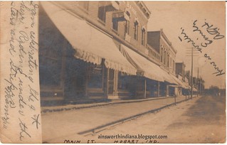
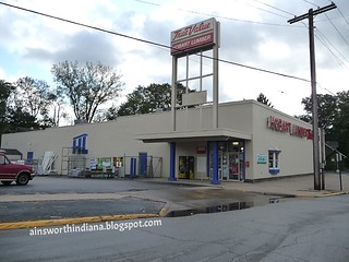
At some point after 1920 Charles found he'd had enough of steel mills. By 1926 he was living in Ainsworth, running for 2nd Precinct Committeeman. He and Lucy had probably moved there to operate the grocery store. In 1927 Lucy was appointed postmistress.

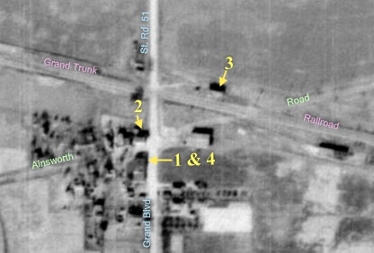
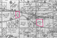
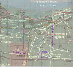
Our favorite Enumerator in the 1930 census, Elizabeth L. Fredrick, places the couple and their two children on "Ainsworth Road," by which, as is evident from the other names listed, she meant State Road 51 — so the grocery store was at the intersection of Ainsworth Road and Ainsworth Road. I haven't found out yet what the present-day Ainsworth Road was called back then, other than the "Old Sac Trail."

He may have been a pretty good shot, our Charles. We find a Charles Popp involved in a Valparaiso gun club, winning a trophy in 1930, but I'm not sure this is the same man. The region was crawling with Popps at the time.

By 1931, Charles had had enough of either Ainsworth or the grocery business, and the family moved to Merrillville. I don't know what occupation he pursued there. In fact, I've pretty thoroughly lost sight of this branch of the Popp family once they left Ainsworth.

Charles died in 1963, Lucy in 1987.


Sources:
♦ Ancestry.com. 1900 United States Federal Census [database on-line]. Provo, UT, USA: Ancestry.com Operations Inc, 2004. Original data: United States of America, Bureau of the Census. Twelfth Census of the United States, 1900. Washington, D.C.: National Archives and Records Administration, 1900. T623, 1854 rolls.
♦ Ancestry.com. 1910 United States Federal Census [database on-line]. Provo, UT, USA: Ancestry.com Operations Inc, 2006. Original data: United States of America, Bureau of the Census. Thirteenth Census of the United States, 1910. Washington, D.C.: National Archives and Records Administration, 1910. T624, 1,178 rolls.
♦ Ancestry.com. 1920 United States Federal Census [database on-line]. Provo, UT, USA: Ancestry.com Operations Inc, 2009. Images reproduced by FamilySearch. Note: Enumeration Districts 819-839 on roll 323 (Chicago City) Original data: Fourteenth Census of the United States, 1920; (National Archives Microfilm Publication T625, 2076 rolls); Records of the Bureau of the Census, Record Group 29; National Archives, Washington, D.C.
♦ Ancestry.com. 1930 United States Federal Census [database on-line]. Provo, UT, USA: Ancestry.com Operations Inc, 2002. Original data: United States of America, Bureau of the Census. Fifteenth Census of the United States, 1930. Washington, D.C.: National Archives and Records Administration, 1930. T626, 2,667 rolls.
♦ Ancestry.com. Social Security Death Index [database on-line]. Provo, UT, USA: Ancestry.com Operations Inc, 2009. Original data: Social Security Administration. Social Security Death Index, Master File. Social Security Administration.
♦ Ancestry.com. World War I Draft Registration Cards, 1917-1918 [database on-line]. Provo, UT, USA: Ancestry.com Operations Inc, 2005. Original data: United States, Selective Service System. World War I Selective Service System Draft Registration Cards, 1917-1918. Washington, D.C.: National Archives and Records Administration. M1509, 4,582 rolls. Imaged from Family History Library microfilm.
♦ Ancestry.com. U.S. World War II Draft Registration Cards, 1942 [database on-line]. Provo, UT, USA: Ancestry.com Operations Inc, 2007. Original data: United States, Selective Service System. Selective Service Registration Cards, World War II: Fourth Registration. National Archives and Records Administration Branch locations: National Archives and Records Administration Region Branches.
♦ Ballantyne, Dorothy, and Robert Adams. Along the Route: A History of Hobart, Indiana, Post Offices and Postmasters. Hobart: The Hobart Historical Society, Inc., 1979.
♦ "Charles Popp Wins Trophy at Gun Shoot." Vidette-Messenger (Valparaiso, Ind.) 21 Apr. 1930. Access Newspaper Archive. Lake County (IN) Public Library 25 Nov. 2009 .
♦ "Legal Notice." The Times (Hammond, Ind.) 27 Apr. 1926. Access Newspaper Archive. Lake County (IN) Public Library 29 Nov. 2009 .
♦ "Merrillville." The Times (Hammond, Ind.). 10 May 1933. Access Newspaper Archive. Lake County (IN) Public Library 27 Nov. 2009 .
♦ "PetrusFranzFamily." Ancestry.com 28 Nov. 2009 .
♦ United States Department of Labor. Descriptions of Occupations: Metal Working, Building and General Construction, Railroad Transportation, Shipbuilding. Washington: Government Printing Office, 1918.

Saturday, November 28, 2009

Train Graffiti

A freight train stopped in Ainsworth this morning.

StoppedFreightTrain11-28-09
(Click on images to enlarge)

I hustled out there with my camera to get some pictures of chalk and other line graffiti.

Watchman1
Watchman2
3-D
Duelinggraffiti
Jasper
JenQ2000
SummerinLove
Wingedcoffin

♦    ♦    ♦

The newspaper archive I use through the Lake County Public Library is undergoing maintenance and has become temperamental and unreliable. The work is supposed to be finished and a new search engine in place eventually — on November 19 they told me this would take place "within a month or so." But at present, research is very difficult and slow.

Thursday, November 26, 2009

Grand Trunk Western Transit Freight Waybill 1957

Here it is, folks, the post you've been waiting for — an unused 1957 Grand Trunk Railroad Freight Waybill!

Grand Trunk Western RR Waybill 1957

I have reached the pinnacle. I can end my blog now.

Wednesday, November 25, 2009

The Clearing in the Woods

If you go wandering in Deep River County Park north of the railroad bridge, you might accidentally stray from the path, inadvertently fight your way through the blackberry thorns, unmindfully duck and weave through the low-hanging branches, coincidentally slog through a natural drainage channel — and all at once find yourself in a wide open clearing.

Clearing

Or you could do it the easy way, and walk along the tracks until you see the clearing. Then you just have to scramble down the side of the railroad grade, which is steep and rocky, but it's better than blackberries. And at the bottom, there you are: in that magical clearing where the Railroad Elves hold their annual revelry.

We know the clearing must have been made by elves, because it's surrounded by dense forest and yet no trees grow there. Q.E.D.

We know they are Railroad Elves, because it's beside the railroad. Also: they drink spiked punch.
Spikes

And they've been doing it for a long, long time.
AncientSpikeCan

They come here by night — we know it's by night, because they are never seen in daylight — get drunk on their spiked punch and dance their wild dances.

When they can dance no more, they run away on their little two-toed elven feet.
Path

They run out to the soybean field, where they eat every last soybean.
SoybeanField

And then they disappear for another year.

Tuesday, November 24, 2009

The Wandering Post Office

PostOffice


The Ainsworth Post Office, in its 52-year existence, revolved clockwise around the Ainsworth Triangle to end exactly where it began.

(1) In January 1882, Ainsworth's first post office opened in a general store (I think this store was later operated by William and Carrie Raschka) on the southwest corner of the intersection of Ainsworth Road and State Road 51.

(2) In 1927, it moved to Charles and Lucy Popp's grocery store across Ainsworth Road.

(3) In 1931, it moved into the Grand Trunk Railroad station and was administered by the railroad's agent, E.G. Clark.

(4) Subsequently (date unknown), it moved back into the general store where it had started. The Ainsworth Post Office ceased operation on February 15, 1934, and Ainsworth's mail delivery was handled by the Hobart Post Office.

The table below lists the seventeen people who held the position of Postmaster and the dates of their appointment:

Name of Postmaster Date Appointed
Henry Chester 1/10/1882
Francis W. Clinton 9/4/1885
George Guernsey 9/21/1888
Mary E. Guernsey 5/23/1889
Willard O. Halsted 5/11/1893
Elmer Griffith 5/15/1901
Frank Coyle 1/14/1902
Hugh Dotzer 1/28/1904
William Raschka 5/24/1904
Mr. Pintz[1] 9/7/1915
Amelia Goldman 12/14/1915
Henry J. Paulus 5/15/1923
Lucy Popp 6/10/1927
E.G. Clark 3/11/1931
Nellie Slaters 9/3/1931
William Summer 10/29/1932
Milton Guernsey 7/12/1933

Source: Dorothy Ballantyne and Robert Adams. Along the Route: A History of Hobart, Indiana, Post Offices and Postmasters. Hobart: The Hobart Historical Society, Inc., 1979.

_______________
[1] This postmaster's name was actually Max Mintz.

Monday, November 23, 2009

Hobart Then and Now: Main Street, West Side

Post-1907 and 2009

Main Street West 1907
Main Street West 2009
(Click on images to enlarge)

We're on Main Street, looking at the west side, facing south from a point slightly north of Third Street

The postcard has been used but somehow escaped a postmark. Although the Strattan building (the big yellow building) was built in 1870, the superstructure on its roof did not exist before 1907.

There is a "Strattan Opera House" sign at the top of the corner façade. The Strattan Opera House closed around 1916, so we can tentatively date this image between 1907 and 1916, but that's assuming the sign was removed when the Opera House closed.

Source: Elin B. Christianson. Hobart's Historic Buildings. Hobart: Hobart Historical Society, 2002.

Sunday, November 22, 2009

Aerial Photo: 1958

Photograph courtesy of the Indiana State Archives, Indiana Commission on Public Records.
(Click on image to enlarge)
Photograph courtesy of the Indiana State Archives, Indiana Commission on Public Records.


My first impulse was to write, "Nothing to see here, folks. Move along," but then I took a better look.

Houses have popped up in the countryside like zits on a high-school junior's face the week before prom. Comparing this photo with the three 1939 aerial photos, we see several new houses in the vicinity of Ainsworth School (at the center of the photo) and a whole enclave along Old Lincoln Highway west of Dekalb Street; the land along Clay Street and Route 30 has grown neighborhoods where in 1939 it grew only scattered farmhouses.

If the observer effect and the critical-mass phenomenon had a love child, they might call it People Moving Out to the Country. "I've had it with the city," you might say, "with the crowding and the traffic and the crime. I'm moving out to the country." But by moving to the country, you change the country. Perhaps you move into an existing house, so your impact is softened. Still, you bring your citified ways with you, for example, putting up a chain-link fence to contain your dogs, and asking rabbit-hunters to stay out of your field. Or perhaps you buy part of a field or a forest, bulldoze it barren and build a new house. "Ah, the country life!" you might say as you walk out in the summer sunshine to spray herbicide on the wildflowers marring your perfect lawn. And then comes another bulldozer, a new neighbor, another three cars, another perfect lawn. And another. And another. And another. And then a big box store goes up down the street, and then another, and you find yourself sitting behind the wheel of your car, complaining about the traffic and wondering how many more people can move out to the country before it becomes suburbia.

But the analogy to critical mass is probably inapt. You don't see or feel a bomb going off. The country ceasing to be the country is more like a person ceasing to be young. When did it happen? How do you know if it's happened yet? And, really, is it so bad? Being old has its good points, even when your knees ache and you have to take your glasses off to read.

… I can't believe I wrote all this nonsense based on one 1958 aerial photo. I am going to go do something productive, like cut down trees.

Saturday, November 21, 2009

Hobart Then and Now: Main Street, East Side, Looking South from Third St.

1919 and 2009

Main Street 1919
Main Street 2009
(Click on images to enlarge)

Hobart has done a good job of preserving its historic buildings, but not such a good job on its historic level of traffic. Or on its historic groups-of-loafers-in-doorways.

The top image is from a postcard postmarked 1919. At the far left is the First State Bank. The second-story awnings on the side read: "Dentist." Next door is "The Bee Hive," whatever that might have been. At mid-block is a "Garage." The other signs I can't read.

At the far right is the Strattan building, built around 1870, demolished in … when was it? 2008?

I'm not sure what that low rectangular thing is across Main Street in the far distance. It looks vaguely like a locomotive, sitting on the tracks blocking the street. Or maybe it's a combination of a delivery truck and a house further south.

Here's a slightly earlier shot of the east side of the street, again looking south from Third. This is from a postcard postmarked 1908:

Main Street 1908

Check out that wood-plank sidewalk.

Friday, November 20, 2009

Commerce: Tonagel

I came across this in a 2007 Post-Tribune article:
Mary Henning of Valparaiso … attended Ainsworth School and used to walk to Tonical's (she's not sure of the spelling) grocery store where the school supply store now is located on 73rd Avenue (called Lincoln Highway in those days). There also was a place called Hoosier's Nest that dispensed goodies for the kids.
The spelling was Tonagel … or maybe it wasn't:
Sunday supper guests of Mr. and Mrs. Chas. Bennett were Mr. and Mrs. Cecil Tonagal of Ainsworth, Ind.
No, I think that 1940 tidbit of social gossip contained a misprint. Everywhere else I see this name, it's Tonagel.

We first meet Cecil R. Tonagel in 1910, when he's a boy of six living with his parents, Charles and Mary, big brother Victor and big sister Edna, in Washington Township, LaPorte County, Indiana. It's a farming, land-owning family. In 1920, he's still at home on the family farm. Ten years later, he's moved out and married Ruby A. Rosenquist, and they have a one-year-old son, Donald. Still in Washington Township, they live in a rented house and Cecil farms in a general way.

Beyond 1930, census records are not available and we have to try to keep track of the Tonagels through the newspapers. [2014 update: The 1940 Census shows Cecil and Ruby living near the intersection of 73rd Avenue and State Road 51, operating their own grocery. They have two children, Donald (11) and Carol (9). The household includes Ruby's parents, Charles and Amanda Rosenquist.]

In 1934, "Mr. and Mrs. Tonagel" advertised a Thanksgiving Dance at Walnut Gardens on Thursday, November 29. The Walnut Gardens was a dance hall on 40 acres along the Lincoln Highway, west of Valparaiso; it had gone into receivership in 1930. The Tonagels advertised it as "opening under new management" with a "new orchestra." I believe these Tonagels to be our Cecil and Ruby because a year later, an advertisement for Mobilgas named "Cecil Tonagel, Walnut Gardens, Road 30" as one of its local dealers.

In 1939 the Vidette-Messenger noted with amusement that "Mr. and Mrs. Cecil Tonagel, Ross township residents," had been chosen to sit on the same jury, and speculated that the deliberations would be "a lot of fun." No follow-up on what the verdict was.

The Tonagels had another child, Carole (or Carol Jo), who by 1941 was old enough to visit relatives in Chesterton without her parents.

I don't know what became of the Walnut Gardens venture. The next glimpse we get of the Tonagels is in a strange entry in the local directory for 1952-53:
Tonagel, Carol, Old Lincoln Hwy., Rte. 5, Ph., Office, NIPSCO.
Tonagel, Cecil R., Old Lincoln Hwy., Rte. 5, Ph., Grocery, Self Employed, HO, wife Rubie.
Tonagel, Donald, Old Lincoln Hwy., Rte. 51, Ph., Sales Dept., Blainus, Gary.
I say "strange" because Route 5 is too far east to be included in this local directory, which covers no further east than south Portage Township. If we assume that "State Road 5" is a misprint for "State Road 51" (where Donald is located), these entries make perfect sense and put Cecil, Ruby and family, as well as the grocery store, right where Mary Henning remembered them: on the northeast corner of the intersection of State Road 51 and Old Lincoln Highway.

I don't know when the grocery business closed. A Hobart city directory lists Ruby Tonagel's residence address as "RD 2," which might be Ainsworth but I don't know. No word is given of Cecil or anybody else, or the grocery store.

By the early 1990s the Tonagels had moved to Hobart. Cecil died in 1994, Ruby in 1995.

Sources:
♦ Ancestry.com. 1910 United States Federal Census [database on-line]. Provo, UT, USA: Ancestry.com Operations Inc, 2006. Original data: United States of America, Bureau of the Census. Thirteenth Census of the United States, 1910. Washington, D.C.: National Archives and Records Administration, 1910. T624, 1,178 rolls.
♦ Ancestry.com. 1920 United States Federal Census [database on-line]. Provo, UT, USA: Ancestry.com Operations Inc, 2009. Images reproduced by FamilySearch. Note: Enumeration Districts 819-839 on roll 323 (Chicago City) Original data: Fourteenth Census of the United States, 1920; (National Archives Microfilm Publication T625, 2076 rolls); Records of the Bureau of the Census, Record Group 29; National Archives, Washington, D.C.
♦ Ancestry.com. 1930 United States Federal Census [database on-line]. Provo, UT, USA: Ancestry.com Operations Inc, 2002. Original data: United States of America, Bureau of the Census. Fifteenth Census of the United States, 1930. Washington, D.C.: National Archives and Records Administration, 1930. T626, 2,667 rolls
♦ Ancestry.com. U.S. Public Records Index [database on-line]. Provo, UT, USA: Ancestry.com Operations Inc, 2009. Original data: Merlin Data Publishing Corporation, comp. Historical Residential White Page, Directory Assistance and Other Household Database Listings. Merlin Data Publishing Corporation, 215 South Complex Drive, Kalispell, MT 59901.
♦ Ancestry.com. Social Security Death Index [database on-line]. Provo, UT, USA: Ancestry.com Operations Inc, 2009. Original data: Social Security Administration. Social Security Death Index, Master File. Social Security Administration.
♦ Burns, Bob. "Whatever happened to fender skirts and steering knobs?" Post-Tribune (Gary, Ind.) 10 Jun. 2007. NewsBank, inc. Lake County (IN) Public Library 18 Nov. 2009 .
♦ "Chesterton News Briefs." Vidette-Messenger (Valparaiso, Ind.) 9 Aug. 1941. Access Newspaper Archive. Lake County (IN) Public Library 19 Nov. 2009 .
♦ "Chesterton News Briefs." Vidette-Messenger (Valparaiso, Ind.) 1 Jul. 1942. Access Newspaper Archive. Lake County (IN) Public Library 19 Nov. 2009 .
♦ "Chesterton News Items of the Day." Vidette-Messenger (Valparaiso, Ind.) 9 Aug. 1929. Access Newspaper Archive. Lake County (IN) Public Library 19 Nov. 2009 .
Directory, 1952-53 Hobart-Wheeler-New Chicago-Ainsworth-Green Acres-Deep River-South Hobart Twp.-South Portage Twp. Nappanee: Advance News, 1952.
♦ "Hurlburt." Vidette-Messenger (Valparaiso, Ind.) 12 Jun. 1940. Access Newspaper Archive. Lake County (IN) Public Library 19 Nov. 2009 .
♦ "Looking Backward." Vidette-Messenger (Valparaiso, Ind.) 18 Jul 1940. Access Newspaper Archive. Lake County (IN) Public Library 19 Nov. 2009 .
♦ "Mobilgas advertisement." Vidette-Messenger (Valparaiso, Ind.) 2 Jul. 1935. Access Newspaper Archive. Lake County (IN) Public Library 19 Nov. 2009 .
♦ "'Round About." Vidette-Messenger (Valparaiso, Ind.) 13 Jan. 1939. Access Newspaper Archive. Lake County (IN) Public Library 19 Nov. 2009 .
♦ "Walnut Grove advertisement." Vidette-Messenger (Valparaiso, Ind.) 27 Nov. 1934. Access Newspaper Archive. Lake County (IN) Public Library 19 Nov. 2009

Tuesday, November 17, 2009

Chester's Camp Location: Newspaper Testimony

I took some photos this morning of Old Lincoln Highway in the vicinity of Dekalb Street so that those who aren't familiar with that section of the road will have a better idea of how it looks.

Starting a little more than one-tenth of a mile east of Dekalb Street, moving west along 73rd Avenue (Old Lincoln Highway):

DangerousCurve1
(Click on images to enlarge)

HonestTheresaCurveAhead2

On the north side of the street, there's a piece of flat land that would make a nice place for a tourist camp, if you know what I mean:

NicePlaceforaTouristCampAintIt3

The camera seems to flatten the road out somewhat. The road dips through this curve:

GuardrailforPeopleWhoDidntNoticethe

A shallow creek runs under the road at the lowest point of the dip:

ShallowStreamatBottomofDip5

We've gone around the curve; now we're looking up toward the crest of a hill to the west, and that's Dekalb Street on the right:

LookingWesttoCrestofHill6

Turning around at Dekalb Street (which goes off to the left now) and looking back east, there's the dip-curve again:

LookingEastfromDekalb7

MovingEastthroughtheDipCurve8


Unsurprisingly if Chester's Camp was indeed located near this curve, there were numerous car wrecks in the vicinity. Below are excerpts from the Valparaiso Vidette-Messenger describing some of the accidents:

[Jul. 1929] West Lincolnway at Chester's Camp Dip Curve is Scene of Crash Sunday Morning … Chester's Camp is on an "S" curve with a dip in the road adding further hazard to the drive.

[Jan. 1930] Argie Weider … was approaching the brow of a Hill at the Chester camp, when he was blinded by the lights of an approaching automobile.

[Feb. 1930] The accident occurred … near the Chester camp, between Deep River and Merrillville. Mehok, according to witnesses, rounded the curve at high speed ….

[Jan. 1932] An unidentified man was killed Thursday morning when the automobile he was driving skidded into the ditch on Lincoln Highway, near Chesters' camp, eight miles west of Valparaiso. … [Witnesses] saw the other machine run into a ditch as it rounded a curve near them.

[Oct. 1934] Cars Driven by Chicago and Gary Drivers Crash Early Today Near Chester's Camp on Road 30. … The accident is said to have resulted when one of the cars attempted to cut around another car.

What we can gather from these descriptions is that Chester's Camp was on a dangerous section of road that involved a sharp, dipping curve and a nearby hill — all of which sounds remarkably like the section of 73rd Avenue pictured above.

All the same, I'm not quite ready to invoke the Unscholarly Blogger's Fiat and declare myself satisfied. I don't know what I'll require to do that.

Sources:
♦ "Bright Lights, 'Skiddy' Road Causes Crash." Vidette-Messenger (Valparaiso, Ind.) 9 Jan. 1930. Access Newspaper Archive. Lake County (IN) Public Library 16 Nov. 2009.
♦ "Car Skids Into Ditch, Driver Not Identified." Vidette-Messenger (Valparaiso, Ind.) 29 Jan. 1932. Access Newspaper Archive. Lake County (IN) Public Library 16 Nov. 2009.
♦ "Dean Family Trapped When Making Curve." Vidette-Messenger (Valparaiso, Ind.) 24 Feb. 1930. Access Newspaper Archive. Lake County (IN) Public Library 16 Nov. 2009.
♦ "Hammond Man Held; Drunk at Wheel?" Vidette-Messenger (Valparaiso, Ind.) 8 Jul. 1929. Access Newspaper Archive. Lake County (IN) Public Library 16 Nov. 2009.
♦ "9 Hurt When Autos Collide West of City." Vidette-Messenger (Valparaiso, Ind.) 15 Oct. 1934. Access Newspaper Archive. Lake County (IN) Public Library 16 Nov. 2009.

Monday, November 16, 2009

Location of Chester's Camp: Census Testimony

Let us now praise the name of Elizabeth L. Fredrick, Enumerator in the Fifteenth Census of the United States: 1930. Thanks to her notes on the enumeration schedule that includes the John Chester household, we can get a notion of where Chester's Camp was.

On the left side of the sheet, she notes that it represents the north side of State Road #30 (i.e., the Lincoln Highway). She notes that while the entire sheet is devoted to State Road #30, only the first 17 lines represent Deep River households.

The theory that she is moving west from Deep River, along the north side of State Road #30, is supported by the 1939 plat map of the Ainsworth area. On the census schedule, we find the Hallowell, Baessler and Eason households owning land; looking at the 1939 plat map, we find those same landowners, in that same order, east to west on the north side of State Road #30.

The next name we encounter on the census sheet that matches the 1939 plat map is Hurlburt. We've already met Jacob and Augusta Hurlburt, and we know they owned land on the northeast corner of the intersection of Grand Boulevard and the Old Lincoln Highway.

Continuing west, Mrs. Fredrick records two renters who wouldn't show up on any plat book, and then the Chester household, operating a tourist camp.

West of the Chesters, there are two more renters. The next landowner listed is Albion D. Paine. We've now moved out of Range 7 into Range 8 and my copy of the 1939 plat book seems to be missing the relevant page, so we have to go to the Plat Books of Indiana Counties of uncertain date, estimated on the IUPUI website to be between 1925 and 1941, in order to find Mr. Paine. Here is an excerpt from the undated plat book, showing the Hurlburt and Paine land outlined in pink:

undatedplatmapAinswortharea
(Click on image to enlarge)

So Chester's Camp is west of the Hurlburts and east of the Paines (assuming the land ownership has not varied greatly between the plat book and the census), on the north side of the street.

Here's an aerial view of the area, with the Hurlburt and Paine land holdings marked.
HurlburtPaineaerialanntd
(Click on image to enlarge)
I can't determine where Chester's Camp was using the aerial photos for two reasons. First, when you enlarge them to try to see things at ground level, they become so fuzzy as to be almost useless unless you already know what should be there and you're just trying to confirm it. Secondly, I don't know what should be there. We've already learned that John Chester left this location in 1935, moving his tourist camp operations to the vicinity of Tremont. What became of this Chester's Camp after 1935, whether any part of it was still standing in 1939, and, most importantly, what its layout was, what I should expect to see from the air — I simply don't know.

♦    ♦    ♦

Still to come: newspaper testimony about the location of Chester's Camp.

Sources:
♦ Ancestry.com. 1930 United States Federal Census [database on-line]. Provo, UT, USA: Ancestry.com Operations Inc, 2002. Original data: United States of America, Bureau of the Census. Fifteenth Census of the United States, 1930. Washington, D.C.: National Archives and Records Administration, 1930. T626, 2,667 rolls.
♦ Lake County Title Co. Plat Book of Lake County 1939. n.p., n.p., n.d. Print.
Plat Books of Indiana Counties, Vol. 3, p. 253. Lombard: Sidwell Studios, n.d. IUPUI University Library Program of Digital Scholarship. Historic Indiana Plat Books. Indiana University-Purdue University Indiana. 16 Nov. 2009 .

Sunday, November 15, 2009

Horsey BFFs Again

HorseyBFFsAgain
(Click on image to enlarge)

Doesn't that look like the same two horses I photographed before? I watched them grooming each other for about five minutes this morning.

So after my last post, I took the dog for a long walk, then I took myself for a long nap, and now I feel better.

Between the walk and the nap, I did something I've never done before: I drove up Dekalb Street. All these years of living here, and I never set tire on that street before! It's an interesting little street, and I like it.

Chester's Camp: Purchase of Land

I notice that the Northwest Indiana Genealogical Society moved its photograph of Chester's Camp from "Unknown Lake County" to "Ainsworth." You're welcome, NWIGS. (I'm kidding! I doubt anyone affiliated with NWIGS even knows this blog exists.)

In the following little item from the Vidette-Messenger of July 7, 1926, I think we see John and Emma Chester buying the land where Chester's Camp would be built: "Helmuth Foreman wid to John Chester and wf Emma pt 18-35-7…………..1.00." In other words, part of Section 18, Township 35 North, Range 7 West of the second Principal Meridian — one of the sections comprising Ainsworth, and bisected by the Lincoln Highway. Too bad the newspaper item doesn't say how much land was transferred; that would be helpful to know. Here is Section 18 as it appears in my 1939 plat book:

Section18
(Click on image to enlarge)

In the northwest quarter of Section 18, on the east side of the T-intersection of Lincoln Highway and Dekalb Street (the latter not labeled), is a two-acre parcel without an owner's name. For reasons that I will explain in a later post, I am going to focus on that two-acre parcel.

One of the reasons it will have to be in a later post is because there are so many lines of inquiry branching out from this topic, and I think I have adult ADD. I can feel my brain overheating. I'm not a very adept historian. I have to go take the dog for a walk and let my brain cool off. Maybe tomorrow I can start afresh.

Sources:
♦ Lake County Title Co. Plat Book of Lake County 1939. n.p., n.d. Print.
♦ "Real Estate Transfers." Vidette-Messenger (Valparaiso, Ind.) 7 Jul.1926. Access Newspaper Archive. Lake County (IN) Public Library 15 Nov. 2009 .

Saturday, November 14, 2009

Ainsworth Road = Indian Trail? Part 2

In a previous post, I quoted an affidavit by a long-time Ainsworth resident, Willim Homer Ghearart, which seemed to me to say that Ainsworth Road had started its life as an Indian trail. I said that a map printed in Kenneth J. Schoon's Calumet Beginnings appeared to back up my conclusion.

This morning I got ahold of some free software (Paint.net) that allows me to layer pictures. I took part of the "Indian Trails and Villages" map from Calumet Beginnings and layered it with the corresponding part of a 1990 Rand-McNally road map I have lying around.

Sauk Trail Ainsworth Rd comparison
(Click on image to enlarge)

I tried to align them on two assumptions: that the Lake-Porter county line was the same in both, and that Old Lincoln Highway and the Sauk Trail should correspond in the area of Merrillville. The heavy white lines are the Indian trails from Schoon's map. The Rand-McNally road markings are finer lines. My notes are in purple.

With that alignment, the part of the trail branching off from the Sauk Trail, crossing Deep River and then the county line, does correspond pretty well with Ainsworth Road.

On the other hand, the Lake Michigan shorelines don't line up, so perhaps I've made a mistake.

On the third hand, this blog is not a scholarly work, and I'm glad of that — it means I don't have to get my footnotes right (although I do sometimes make a half-hearted attempt to follow MLA format). It means I can engage in wild speculation, and build theoretical castles on the flimsiest of evidential foundations. And for my purposes today, it means I can disregard the mismatched shorelines, declare myself satisfied, and henceforward go around telling everybody that Ainsworth Road used to be an Indian trail.

Friday, November 13, 2009

Grand Trunk Railway System Timetable 1922

Grand Trunk Railway System Public Timetable 1922

The Index to Stations lists Ainsworth, but tells us that if we want to know when the train stops there, we have to consult the Chicago District Timetable, which apparently is a separate publication. *sigh*

As you can see, I've gone back to Scribd.com. All relationships have their problems; we're going to try to work things out.

Thursday, November 12, 2009

…Or on the Rose, If You Haven't Got Any Pumpkins

Frost-Covered Rose
Frost on a rose bush in my front yard
(click on image to enlarge)


When the Frost is on the Punkin
by James Whitcomb Riley

WHEN the frost is on the punkin and the fodder's in the shock,
And you hear the kyouck and gobble of the struttin' turkey-cock,
And the clackin' of the guineys, and the cluckin' of the hens,
And the rooster's hallylooyer as he tiptoes on the fence;
O, it's then the time a feller is a-feelin' at his best,
With the risin' sun to greet him from a night of peaceful rest,
As he leaves the house, bareheaded, and goes out to feed the stock,
When the frost is on the punkin and the fodder's in the shock.

*   *   *

The husky, rusty russel of the tossels of the corn,
And the raspin' of the tangled leaves as golden as the morn;
The stubble in the furries—kindo' lonesome-like, but still
A-preachin' sermuns to us of the barns they growed to fill;
The strawstack in the medder, and the reaper in the shed;
The hosses in theyr stalls below—the clover overhead!—
O, it sets my hart a-clickin' like the tickin' of a clock,
When the frost is on the punkin and the fodder's in the shock.

*   *   *

I don't know how to tell it—but ef such a thing could be
As the angels wantin' boardin', and they'd call around on me—
I'd want to 'commodate 'em—all the whole-indurin' flock—
When the frost is on the punkin and the fodder's in the shock.


Here is Hamlin Garland, writing a recollection for the American Academy of Arts and Letters in 1922:
In 1892 I visited Riley at his native town of Greenfield, Indiana, and the town and country gave moving evidence of the wonder-working power of the poet. To my eyes it was the most unpromising field for art, especially for the art of verse. The landscape had no hills, no lakes, no streams of any movement or beauty. Ragged fence-rows, flat and dusty roads, fields of wheat alternating with clumps of trees — these were the features of a country which to me was utterly commonplace — and yet from this dusty, drab, unpromising environment Riley had been able to draw the honey of woodland poesy, a sweet in which a native fragrance as of basswood and buckwheat bloom mingled with hints of an English meadow and the tang of a Canada thistle.
Garland's memoir, A Son of the Middle Border, gives the impression that he thought farming a miserable back-breaking business and that he was glad to have escaped its isolation and mental tedium, so perhaps some little corner of his mind thought Riley a sentimentalist, but if so he graciously kept that opinion to himself. On the other hand, Garland, sensitive to the beauty of the countryside, respectful and compassionate toward the people who farmed it, no doubt could appreciate Riley's ability to speak to the hearts of rural and small-town folk.

And speak to them he did; Riley was immensely popular in the late 19th and early 20th centuries. Hobart High School's yearbook of 1926 is dedicated to him.

So — no, Reader, I have not gone off on a tangent completely unrelated to Ainsworth. Because I'm sure that people in Ainsworth read and appreciated Riley's poems. And if I want to evoke the Ainsworth of a the early 20th century, I have to quote Riley and his like.

One thing that strikes me as I pore through those census reports is the prevalence of farming in local households. You go down the list of families, and it's farmer, wife, children; farmer, wife, children, widowed mother; farmer, wife, children, hired hand; farmer, wife, children, boarder; until you finally strike "retail merchant" or "tourist camp operator," and you think, "What's that weirdo doing here?"

Yesterday was a beautiful day, so I went to work outside. I dug in the heavy clay soil to plant raspberries, then I hauled 12 gallons to water them, then I hauled wheelbarrow after wheelbarrow of heavy, wet wood chips to mulch them.

So many times I paused in my work to stand in the sunshine, look up at the bright blue November sky, and listen to the silence. If only there were more of it! — but then, it's a rare and precious commodity around here. I think that cloud cover is somehow involved, as if the clouds reflected the noise back to earth, but on these windless, perfectly clear days, the distant roar of Route 30 goes up, up, up to eternity and I can almost hear the world without cars. Birds chirping, a breeze stirring the few leaves still on the trees, or rustling through the dried-out orchard grass; now and again a horse neighing, a dog barking, a human voice carrying through the clear air from the stable down the road.

It's the sort of scene that makes you want to get your camera and take a picture, but you know it's pointless because what the camera is going to produce is a small rectangular image of an ordinary fall landscape, not what you're seeing. If you were the poetizing type, you might write a poem, but then later generations will come along and think you an irritating sentimentalist, good only for historical purposes.

I do wonder how Ainsworth people of a hundred years ago felt about silence. They had it in spades — in their fields, in their houses; no cars, no radios, no televisions. They didn't need to stop to listen and marvel on a rare clear day. They had to exert themselves if they wanted not to hear it.

As Bronson Pinchot (of all people!) said in an interview with the Onion, "Well, everything there is so picturesque, you forget that the price of picturesque is boredom."

On the other hand, you have Riley's popularity as a historical fact.

I do wonder.

Wednesday, November 11, 2009

Hobart Then and Now: The "Doughboy" Monument

Circa 1930s and 2009

Doughboy Monument 1930s
Doughboy Monument
(Click on images to enlarge)

This monument was originally dedicated on November 11, 1925 to the Hobart soldiers who died in World War I. I don't know when the first photograph was taken, but to my mind the caption ("World War Monument") suggests it was before World War II.

The monument was rededicated in 2002 and now honors the soldiers Hobart lost in both World Wars, Korea and Vietnam.

A closer look at the statue itself:

Sculpture Doughboy

The inscription on its base, with the title of the statue and the name of the sculptor:

Title and Sculptor

The plaque in front, listing those who died in the World Wars:

World Wars list of casualties

The plaque on the side, listing those who died in Korea and Vietnam:

Korea and Vietnam casualties list

Tuesday, November 10, 2009

John Chester

John Jarvis Chester was the eighth of Henry Chester's nine children, and the second of three borne by Mary E. (Baird) Chester, Henry's third wife. We've looked at his legal difficulties and his bereavements and final tragedy; now let's go to the governmental records to sketch out the less newsworthy facts of his life.

Although his gravestone gives his birth year as 1888, all the official records I could find accord with a birth date of September 11, 1885.

Reader, did you know the 1890 federal census had been destroyed? I didn't, until I started doing this research. In January 1921 there was a fire in the Washington, D.C. building that housed the 1890 census, and the records were so damaged by water as to be deemed unreadable and thrown out.

That is why the first official glimpse we get of John Chester is in the 1900 census, when he was a boy of 15 living in his parents' house along with his little sister, Daisy. (Big brother Jerome had already moved out.)

On August 31, 1905, at the age of 20, he married Emma A.B. Klemm.

The 1910 census found him living in Ross Township, farming in a general way and renting the house where he, Emma and their two little girls lived.

When World War I came, John was living on Harrison Street in Gary, Indiana, employed at Illinois Steel Company as a rougher. His draft card notes that he had grey eyes and brown hair, and was of medium height with a slender build. He did not serve in the army — deemed ineligible, it seems, because of his physical problems, described by the examiner as: "Loss of left vision, 1 finger on left hand crippled, thumb, left limb short."

I have not found anything to explain how he received those injuries, but both lines of work he had followed up to this point — farming and steel working — were dangerous.

In 1920 he was working in a Gary steel mill as an oiler (that's what it looks like on the census sheet, and a pox on census takers with bad handwriting). He and Emma now had four children: three daughters and a son. The family had prospered well enough to buy their home.

Sometime in the 1920s John and Emma left Gary to open their tourist stop along the Lincoln Highway. As we've seen, by 1927 the lunch stand was in business. In the 1930 census John described himself as a tourist camp operator; he employed his son William as an attendant, but no other family member is listed as working there. John's widowed mother had joined the household, while their eldest daughter, Mamie, had married and moved out in 1928. The Chesters owned their home.

And there the official record ends. Neither Emma, nor Ella Mae (John's second wife), nor John himself would survive to be counted in the 1940 census.

Sources:
♦Ancestry.com. 1900 United States Federal Census [database on-line]. Provo, UT, USA: Ancestry.com Operations Inc, 2004. Original data: United States of America, Bureau of the Census. Twelfth Census of the United States, 1900. Washington, D.C.: National Archives and Records Administration, 1900. T623, 1854 rolls.
♦Ancestry.com. 1910 United States Federal Census [database on-line]. Provo, UT, USA: Ancestry.com Operations Inc, 2006. Original data: United States of America, Bureau of the Census. Thirteenth Census of the United States, 1910. Washington, D.C.: National Archives and Records Administration, 1910. T624, 1,178 rolls.
♦Ancestry.com. 1920 United States Federal Census [database on-line]. Provo, UT, USA: Ancestry.com Operations Inc, 2009. Images reproduced by FamilySearch. Original data: Fourteenth Census of the United States, 1920; (National Archives Microfilm Publication T625, 2076 rolls); Records of the Bureau of the Census, Record Group 29; National Archives, Washington, D.C.
♦Ancestry.com. 1930 United States Federal Census [database on-line]. Provo, UT, USA: Ancestry.com Operations Inc, 2002. Original data: United States of America, Bureau of the Census. Fifteenth Census of the United States, 1930. Washington, D.C.: National Archives and Records Administration, 1930. T626, 2,667 rolls.
♦Ancestry.com. Indiana Marriage Collection, 1800-1941 [database on-line]. Provo, UT, USA: Ancestry.com Operations Inc, 2005. Original data: Works Progress Administration, comp. Index to Marriage Records Indiana: Indiana Works Progress Administration, 1938-1940.
♦Ancestry.com. World War I Draft Registration Cards, 1917-1918 [database on-line]. Provo, UT, USA: Ancestry.com Operations Inc, 2005. Original data: United States, Selective Service System. World War I Selective Service System Draft Registration Cards, 1917-1918. Washington, D.C.: National Archives and Records Administration. M1509, 4,582 rolls. Imaged from Family History Library microfilm.
♦"Former Local Man Marries." Vidette-Messenger (Valparaiso, Ind.) 30 Mar. 1928. Access Newspaper Database. Lake County Public Library 10 Nov. 2009 .

Monday, November 9, 2009

Aerial View of Hobart circa 1954

Hobart 1954 Aerial-1
(Click on image to enlarge)

The caption on the back of this postcard is "Aerial View of Downtown Hobart, Indiana." There is no postmark, but someone wrote on the back: "Arrived here 6 o'clock Friday eve. June 25 1954." No address.

If this were pre-1953, the Old Mill would still be standing along the edge of the lake in the upper right. I don't see anything I can identify as the Old Mill, but I have a hard time imagining what it would have looked like from the air.

Sparse posts lately, but I'm taking advantage of the nice weather to work outside.

Sunday, November 8, 2009

A Ladybug in a Reflective Mood

Oh, look, an artsy-fartsy foto!

LadybugonMirror
(Click on image to enlarge)

Whenever we get warm weather after cold, the ladybugs invade my kitchen. This particular ladybug was walking around and around and around this mirror on the worktable.

Saturday, November 7, 2009

Ruins of Ainsworth: Barbed Wire Fence

We're having a spell of nice weather, so I've been working outside several hours a day, clearing away brush, and particularly the horrible, horrible buckthorn that is trying to take over my land. I also mean to clear out, or at least thin, a line of overcrowded elms in my side yard that grew up along a barbed-wire fence.

I can find remains of that fence not only in my side yard but along the north line of my field, parallel with Ainsworth Road. In some places the barbed wire was supported by metal poles, in other places by heavy square wooden posts, some of which have collapsed onto the ground, while others are still half-standing, leaning at crazy angles. In the heavily overgrown areas, the strands of barbed wire lurk hidden in the brush, but I'd find them quickly enough if I tried to clear the area with my brush mower.

Here, a growing elm has begun to swallow up the barbed wire that was resting against its trunk.

BarbedWire
(Click on image to enlarge)

Friday, November 6, 2009

Hobart Then and Now: Hobart Lumber Company

1962 and 2009

Hobart Lumber 1962
Hobart Lumber 630 Main 2009
(Click on images to enlarge)

That little 1962 store is so cute! Hobart Lumber prospered, it expanded, it got less cute. The site of the little store, on the west side of Main Street, is now their inventory storage. A new main store has been built on the other side of Main Street and slightly to the south.

Hobart Lumber main store 2009

Thursday, November 5, 2009

Soybean Harvest

My farming neighbors have begun harvesting the soybeans. The Grand Trunk Railroad runs past some of the fields, so I walked down the tracks to take pictures. Here is the harvester moving through the soybean field — and it really is dusk, even though my know-it-all camera thought I wanted the shot to look like broad daylight.*

HarvestingatDusk

Ten or fifteen minutes later, the harvester's hopper (if that's the word) was full and the driver backed up, turned and headed off the field, to meet up with the truck that was waiting across the street in the entrance to Big Maple Lake Park. The harvester would discharge the load of soybeans into the truck and go back to work.

Full

As for me, I turned and headed back up the tracks in the near darkness, hoping not to get hit by a train or shot by a deer-hunter or eaten by a coyote.

___________________
*I really, really hate that camera of mine.