(Click on image to enlarge)
Image courtesy of the Indiana Geological Survey, I.U. Bloomington.Well, this is embarrassing. I just realized that if I'd been paying attention when I looked at the
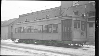
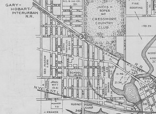
1939 Plat Book, and if it had registered in my brain that "Gary-Hobart Interurban R.R." refers to the streetcar line, I wouldn't have had to schlep my aerial prints over to an old-timer's house to ask if this photo really does show the streetcar line, because according to the plat book, it does. (However, it was a pleasant visit, as always, so I'm not complaining … just embarrassed.)
 (Click on image to enlarge)
This image from the
1939 Plat Book shows the streetcar line, aka the Gary-Hobart Interurban R.R., running through Hobart. By this time its Hobart terminus was at the northwest corner of Third and Main. From there it ran along the north side of Third Street until it crossed the bridge; then it ran down the center of Third Street. Around Ash Street it moved away from Third Street to cross Connecticut and Pennsylvania diagonally. At First Street (now West Cleveland Ave.) it joined up with Washington and ran down the center of that street up to the Pennsy R.R. There it made a turn and ran along the south side of the railroad tracks until they crossed 37th Avenue, at which point the streetcar line turned west to run along the north side of 37th Avenue straight to Broadway in Gary, where it probably met up with the Gary streetcars, which (I am told) ran up and down Broadway.
If you go to Google maps or Mapquest for a present-day satellite image, it looks to me as if that paved alley moving diagonally northwest from Ash Street is a vestige of the streetcar line, as far as it's diagonal — it soon turns straight north and leaves the path of the streetcar. And maybe I'm seeing things, but there seems to be a slight imprint of the streetcar line left in people's yards on either side of Connecticut, mid-way between Second and Third Streets.
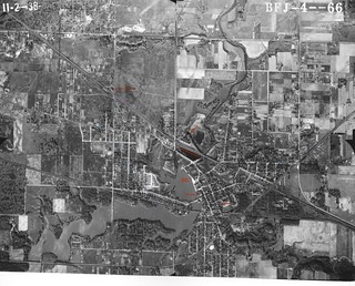
Here's that aerial photo decorated with colored labels. You know how I love doing that. Also a few guesses at what's what.
 (Click on image to enlarge)
I've got 6 or 7 more aerial photos that I'll get up here eventually, but this is the most interesting one.