Someone had told me that you can still see traces of Hobart's
motorcycle racetrack in the landscape, so I was looking on the Google Maps satellite view for it. I didn't see any such thing, but I saw something cute in roughly the same location. I think it's a corn maze. Go and look if you don't believe me. (This is Google Maps, now, not Google Earth, and you really have to zoom in.)
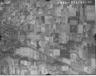
However, to return to history, here's a 1938 aerial view of that general area. It includes an oval line in the fields that could be a racetrack, in what seems to me about right for the location of the
McAuliffe land.
 (Click on image to enlarge)
Image courtesy of the Indiana Geological Survey.Here, I'll do my label thing.
 (Click on image to enlarge)
So? Whaddaya think?


No comments:
Post a Comment