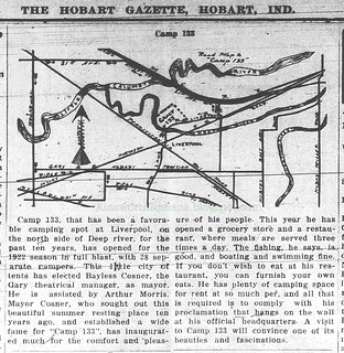
(Click on image to enlarge)
So, where present-day Liverpool Road crosses the Deep River, Camp 133 was on the west side of the road and the north side of the river.
A Calumet Region Historical Guide compiled as a WPA project and printed in 1939 devotes one short paragraph to Camp 133, explaining that it was "so named because 133 was the number of the local theatrical employee's union whose members established the camp in 1913."


4 comments:
The reference of Camp 133 was less about the campground and more a description of an unincorporated area of Hobart Township that shared borders with with cities and towns of Gary, East Gary, Hobart and New Chicago, Indiana. The area extended from Ridge Road with its intersection with Liverpool Road at its south most point. To the north, it touched Central Avenue and to the west bordered with East Gary and New Chicago. Consider for example, the Camp 133 Volunteer First Station as at approximately 4339 E. Liverpool Road, very near the intersection of Liverpool Road and State Street, an area known as Julian's Corners. Children in the area attended Hobart Township schools, Henry S. Evans and River Forest. The firehouse mentioned above and residents were given a Gary designation on their addresses but were not a part of the City of Gary. Eventually, when East Gary became Lake Station, this area was included as part of it.
Thank you for the information!
this is amazing stuff. My dad grew up on State Street and my mom grew up going to Julian's Corner, as she lived right there.
My grandparents owned Julian's corner!
Post a Comment