
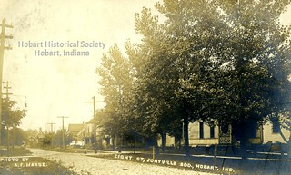
A little map on the "Hobart As It Was" exhibit shows the original Joryville bounded on the north by Eighth Street, on the east by Linda Street, on the south by Ninth Street, and on the west by Lincoln Street — but that was the late-19th-century version; I don't doubt that the name "Joryville" would eventually be applied to a slightly expanded area.
Here's a couple of views from Joryville roughly circa 1910.
(Click to enlarge)
Images courtesy of the Hobart Historical Society.
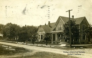
It was evidently a charming neighborhood then, and so it remains to this day — full of interesting old houses and shaded by tall old trees.
I suppose if I wanted to work hard at it, I could figure out where these shots were taken and do a then-and-now thing, but I don't feel like working hard at anything at the moment.


No comments:
Post a Comment