
(Click on image to enlarge)
From the Hobart Gazette of Jan. 2, 1920.
This excerpt from the 1926 Plat Book shows approximately where the little parcel was located (the red rectangle):
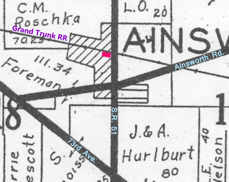
Well, that's right in the heart of the Ainsworth business district! Location, location, location!
The one bit of information I found surprising in this article is that there was once a schoolhouse on that land, and that it was abandoned, not moved. Actually, this is not inconsistent with the 1874 Plat Map (schoolhouse marked in red):
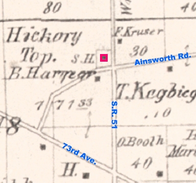
But the little frame building generally considered Ainsworth's first school stood further west along Ainsworth Road.


No comments:
Post a Comment