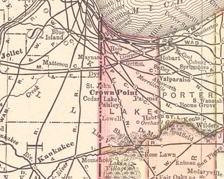
(Click on image to enlarge)
From Rand McNally & Co., Indiana (Chicago: Rand McNally & Co., 1893; from Rand McNally & Co.'s Universal Atlas of the World), via the University of Alabama.
Now that the suspense is ended and Ainsworth has arrived, these maps are getting repetitive, so I will skip over some of the Lake County extracts in my photo set and even more maps on the U. of A. website. If you want to see them, you can go and look at them, you and your high-speed internet connection.
The Indiana Commission on Public Records has sent me aerial photos of Ainsworth and Deep River from 1958, 1965 and 1973, but the promised digital file on CD was not included in the package. I will have to ask them about that. I will scan the photos only as a last resort, because I'm sure the direct-from-CD version would be better quality.


No comments:
Post a Comment