
(Click on images to enlarge)
Images courtesy of the Hobart Historical Society.
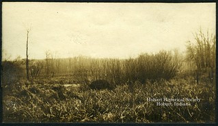
This first photo is unidentified only because it is so generously glued to the album page that I can't lift it enough to read the writing on the back. Looks like a swampy area, and what might be a beaver's den among the vegetation — that would be a subject of interest to "Myself" as a likely place to shoot things, wouldn't it?
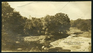
The handwritten note behind the second photo on the page reads:
Looking N. From Grand Trunk Bridge into "Ole's Pasture"I believe the only Grand Trunk bridge in the vicinity of that village was, and is, the one over the Deep River, now in Deep River County Park. I have no idea who Ole was, though. None of my plat maps, from 1874 to 1926, show anyone named Ole owning that land. Might have been a tenant, though.
Sept – 1918
1 – Mile North "Deep River Town."
What really strikes me about this photo is how open the land is. These days, you can't see the land for the trees.


No comments:
Post a Comment